In February 2017, ECMWF concluded an agreement with the Copernicus Marine Environment Monitoring Service (CMEMS) which formalises the terms under which CMEMS provides the Centre with sea-level anomaly products for ocean data assimilation. The ocean data assimilation system is a crucial component of ECMWF’s Earth system approach. It produces both real-time and reanalysed ocean states and it relies on the assimilation of conventional and satellite observations. In particular, radar altimeter sea-level anomaly (SLA) data assimilation improves the representation of the seasonal and inter-annual variability of sea level changes, which is important for extended-range and seasonal-range weather forecasts.
What is CMEMS?
The Copernicus Marine Environment Monitoring Service (CMEMS) is part of the EU’s Copernicus Earth observation programme. It is operated by the French centre of global ocean analysis and forecasting, Mercator Océan.
CMEMS has been designed to respond to issues emerging in the environmental, business and scientific sectors. Using information from both satellite and in situ observations, it provides daily state-of-the-art analyses and forecasts, which offer an unprecedented capability to observe, understand and anticipate marine environment events. For more details, visit the CMEMS website: http://marine.copernicus.eu.
The dedicated major-account ECMWF–CMEMS agreement concluded in February 2017 defines the list of CMEMS SLA products used by ECMWF for ocean data assimilation. It specifies a number of conventions used for the data transfer protocol, such as file name conventions, technical specifications for file transfer and minimum notification periods required by ECMWF for testing purposes before CMEMS implements product changes. CMEMS also provides ECMWF with information about upgraded or new Level 3 and Level 4 global SLA products, as such changes may have an impact on operational numerical weather prediction at ECMWF.
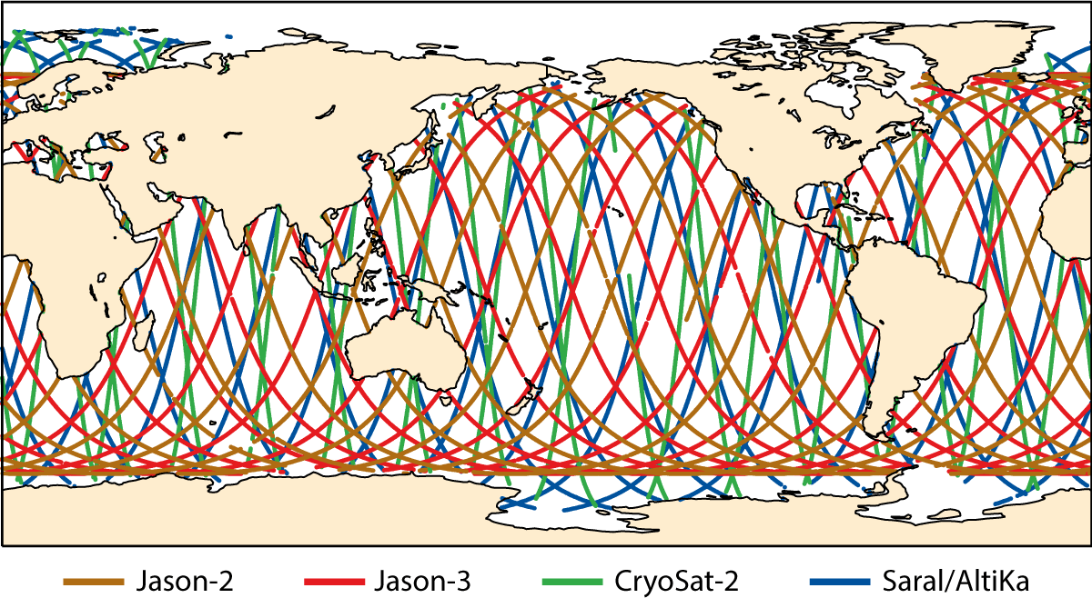
The CMEMS SLA data currently used include observations from several sensors as illustrated in the coverage map, with observations from Jason-2, Jason-3, CryoSat-2 and SARAL/AltiKa operationally assimilated at ECMWF. Future developments in ocean data assimilation and coupled ocean–atmosphere data assimilation will open up possibilities to use a wider range of ocean-related observations.


