

Accurate and timely observations of the land surface are vital for good weather predictions but they can be tricky to come by, ECMWF scientist Patricia de Rosnay says.
How much moisture is there in the soil in a given region, and which parts of the land are covered by snow? The answers may well have a decisive influence on the future weather, including the amount of rainfall or the depths to which temperatures may plummet.
The reason is that different components of the Earth system, such as the atmosphere, the land, the oceans and sea ice, interact with each other: changes in the state of one component are liable to lead to changes in the others.
A team of ECMWF scientists led by Dr de Rosnay is constantly trying to improve the way in which the Centre assimilates observations from interacting parts of the Earth system.
Dr de Rosnay’s interest in weather observations goes back to her childhood in France, when she used a rain gauge to measure the evolution of local precipitation rates.
A degree course in physics, mathematics and fluid mechanics was followed by a Master’s in meteorology and oceanography and a PhD in land surface modelling. Her work in climate modelling soon brought her back to the issue of observations.
“People working on observations were asking how we can model the climate without them. I took their point and, as a researcher at France’s CNRS, got involved in soil moisture remote sensing activities and in a campaign to install a soil moisture measurement network in West Africa,” she recounts.
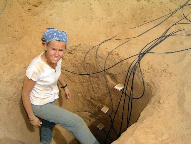
Between 2004 and 2006, Patricia de Rosnay helped to install soil moisture stations in northern Mali. Measuring soil moisture across the Earth’s land surface is tricky. Sensors such as these, while useful for research and verification, cannot give a full and representative picture of soil moisture across the globe to help initialise forecasts.
In 2007, Dr de Rosnay joined ECMWF, where she now leads the Coupled Data Assimilation group in the Research Department.
Soil moisture breakthrough
Soil moisture is a key component of the hydrological cycle. Globally more than 60% of the precipitation over land results from the evaporation of water from the soil and other land surfaces, including vegetation. Soil moisture also has a very large influence on near-surface weather parameters, such as air temperature and relative humidity.
“It is thus important for us to use high-quality soil moisture data to help initialise our weather forecasts,” Dr de Rosnay emphasises.
A breakthrough came in May 2015, when Advanced Scatterometer (ASCAT) satellite data began to be used at ECMWF to help determine soil moisture levels across the globe.
Soil moisture can of course be measured directly, by weighing a sample, drying it and weighing it again. But this is much too slow and laborious for the purposes of numerical weather prediction (NWP).
Sensors can determine soil moisture more quickly by measuring for example the soil’s electric properties. “Such data can be useful for verification purposes,” Dr de Rosnay says, “but they, too, are unsuitable for a timely and representative supply of data from across the globe to help initialise forecasts.”
That is why traditionally observations of 2-metre temperature and relative humidity have been used to help determine soil moisture levels.
This is possible as the three variables are closely linked, but it is an indirect method and relies on the availability of in situ temperature and humidity observations.
ASCAT is an active satellite instrument that works by sending microwave signals to the ground and measuring the properties of the reflected signal, in which information on soil moisture is encoded.
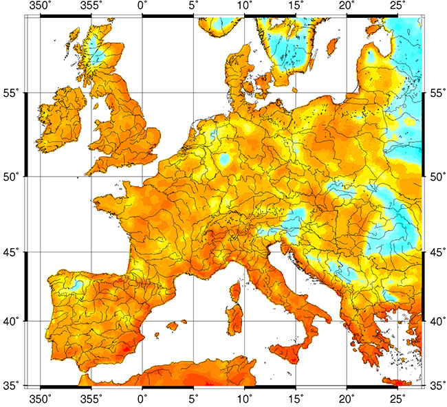
Metop-A ASCAT mean surface soil moisture product for 15-27 May 2011. A drought in parts of Europe in the spring of 2011 was accompanied by a rapid decrease in surface soil moisture between April and May. The ASCAT soil moisture product provides an estimate of water saturation of the 2-3 cm topsoil layer, in relative units between 0 and 100%. (Chart: EUMETSAT)
“Experiments have shown that the assimilation of ASCAT soil moisture data from EUMETSAT’s Metop satellites has helped to improve the consistency between soil moisture and fluxes in our forecasts,” Dr de Rosnay says.
She adds that work is under way to enable the assimilation of additional satellite data from ESA's Soil Moisture and Ocean Salinity (SMOS) Earth Explorer mission, which measures microwave emissions from the Earth's surface to determine soil moisture levels.
Snow data progress
Snow cover has a huge impact on near-surface air temperature. “The energy fluxes between the atmosphere and land are very different depending on whether there is snow on the ground,” Dr de Rosnay explains.
But determining how much snow there is can be tricky, especially near the snow line and in areas with temporary snow cover.
ECMWF combines weather station (in situ) observations of snow depth with satellite snow cover data and information from the model to estimate snow cover and snow mass conditions for each model grid box at the start of a forecast run.
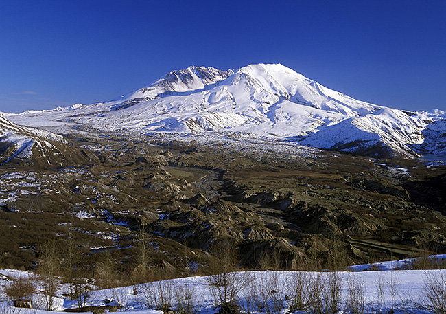
The presence of snow on the ground can be highly variable in time and space, especially near the snow line and in areas with temporary snow cover. This makes the assimilation of snow observations into weather forecasting models crucially important. (Photo: Ingram Publishing/Thinkstock)
“Over the last few years, significant improvements have come both from developing the snow data assimilation system and from more and better in situ snow observations,” Dr de Rosnay says.
“As part of the WMO Snow Watch activities, we are working to enhance the exchange of in situ snow depth observations from more countries on the Global Telecommunication System for NWP applications.”
She adds that it will also be important to develop our ability to improve satellite data assimilation over snow-covered areas.
“By better understanding how snow cover influences the microwave signals received by satellites, we may be able to improve the assimilation of atmospheric data as well as snow data.”
Quest for consistency
Assimilating land, ocean, sea ice and atmospheric observations separately into the forecasting model can lead to inconsistencies in the conditions used to initialise forecasts. These inconsistencies can degrade forecast quality.
Coupled data assimilation aims to resolve this problem by providing consistent initial conditions across different Earth system components.
The IFS land and atmosphere data assimilation are currently ‘weakly coupled’ in the sense that the system allows for interactions between different Earth system components as the forecast evolves, but it assimilates observations for those components separately. For the oceans and sea ice, an uncoupled assimilation approach is used.
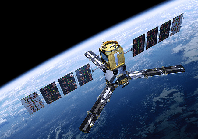
Some satellites can provide data on different components of the Earth system. ESA’s SMOS mission makes global observations of soil moisture over Earth’s landmasses and of salinity over the oceans. It also provides high-quality information on sea-ice thickness and wind speeds over ocean surfaces. (Image: ESA/AOES Medialab)
ECMWF has recently developed a more strongly coupled ocean–atmosphere data assimilation approach in the CERA system.
In CERA, ocean observations can have a direct impact on the initial atmospheric conditions, and atmospheric observations can have an immediate impact on the initial ocean conditions.
“For the future, we’d like to move towards a tighter coupling between the land surface and the atmosphere too,” Dr de Rosnay says. “These developments are part of our move towards an Earth system model as set out in our new ten-year Strategy.”
