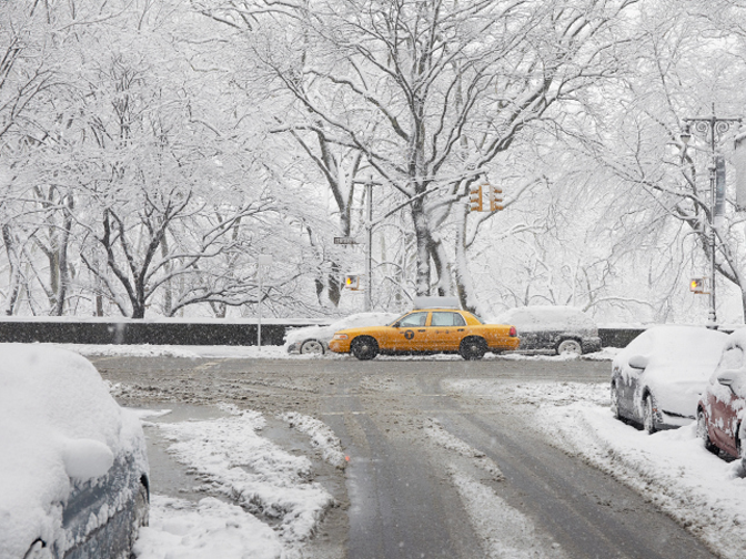

A severe snow storm caused major disruption to parts of the north-east USA on 27 January 2015, with Boston being more affected than New York City. Whilst the ECMWF medium-range forecasts indicated the development of a major snow storm, the predicted path of the storm-centre was generally too far west. The ensemble indicated greater uncertainty in the forecast for New York than for Boston.
On 27 January 2015 a blizzard was expected to affect the north-east coast of the USA including New Jersey and New York City (NYC) and preventative actions were taken (closing the subway, freeways etc.). However, New Jersey and NYC only received relatively little snow – about 5–10 inches in NYC – with the worst affected areas being in a band from eastern Long Island towards Boston and further north; the maximum observed snowfall over the area was over 30 inches.
Weather forecasts always have an element of uncertainty, associated with imperfect knowledge of the initial conditions (the state of the atmosphere at the starting time of the forecast) and the approximations in the computer simulation (model). Consequently, ECMWF uses an ensemble forecasting approach (ENS) to explicitly represent both sources of uncertainty. In contrast, any single realisation cannot capture the confidence level that should be placed in that outcome.
From Saturday 24 January onwards, successive ECMWF ensemble forecasts consistently predicted the development of a major snow storm that would affect the north-east coast of the USA on 27 January. However, whilst there was high confidence in the occurrence of a severe storm, the precise track of the storm remained less certain.
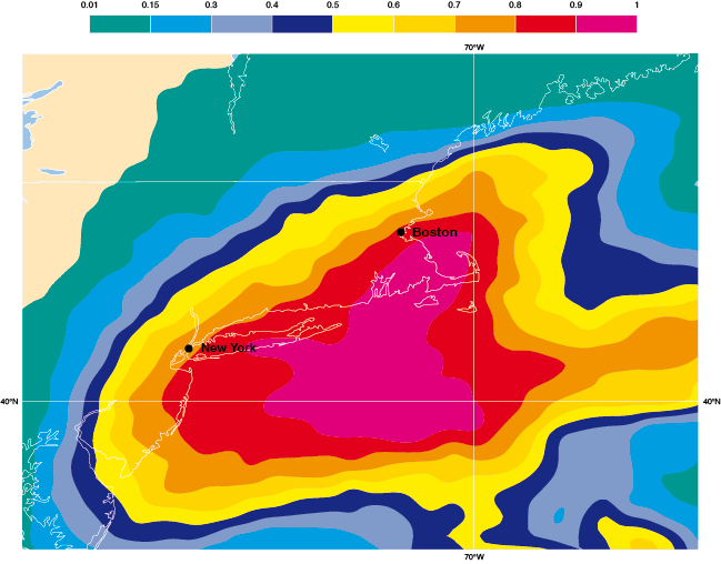
On 25 January most of the 52 ENS members were taking a slightly more westerly track than the forecasts from the previous day. The probability of substantial snow (more than 30mm of precipitation, equivalent roughly to 30cm or 1 foot of fresh snow) was over 80% for both NYC and Boston (Figure 1). This outcome was supported by the single higher resolution member, which was predicting over 40mm rain-equivalent precipitation widely in NE coastal regions, with 50mm in both cities. The overall signal was that a major event was likely to occur in both NYC and Boston. The ENS probabilities show a sharp gradient over the NYC area, see figure; those ENS members that did maintain a track further to the east predicted significantly less snow for NYC although overall this was a less likely outcome.
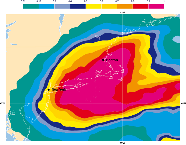
The probability for an exceptional snowfall event for Boston increased with each new forecast. In contrast, for NYC the likelihood of heavy snow decreased from 80% to 60% and then 40% as more ensemble members predicted the storm would pass slightly further to the east (Figure 2). The ensemble demonstrated that the situation was rather more uncertain for NYC than for Boston, even at shorter range.
The ensemble approach is essential to provide forecast users with information about the range of future weather scenarios and the likelihood of high-impact weather events. The ensemble aims to account for all sources of uncertainty in the forecasting system, and ECMWF is continuing to improve its forecasting system, including by increasing its horizontal resolution. The aim is to both reduce and reliably quantify the uncertainty.

Figure 1 - The forecast from 00UTC 25 January 2015: predicted probability of greater than 30mm precipitation accumulated over the 30-hour period from 00 UTC on 27 January to 0600 UTC on 28 January.

Figure 2 - The forecast from 00UTC 26 January 2015: predicted probability of greater than 30mm precipitation accumulated over the 30-hour period from 00 UTC on 27 January to 0600 UTC on 28 January.
