

Prediction of the maximum wave height of extreme events is of tremendous benefit to the marine world. A considerable amount of progress in wave modelling has been achieved in the past 20 years or so and there are definite reasons for further development. A global wave prediction model has been in operations at ECMWF since 1992.
Traditionally, many weather centres have applied their weather forecasts to activities associated with the marine environment. Shipping, fisheries, offshore operations, coastal protection and recreation are all strongly dependent on weather and require marine weather forecasts extending to the limit of the medium-range forecasting period. An important component of the marine weather forecast is the sea state and, therefore, wave forecasting using high quality forecasts of low-level winds or stresses from an atmospheric model is of prime importance. Surface winds should be of high quality as the wind speed error is an important component of the accuracy of the forecast for wave height.
Read more in a new leaflet called 'Ocean Waves at ECMWF'
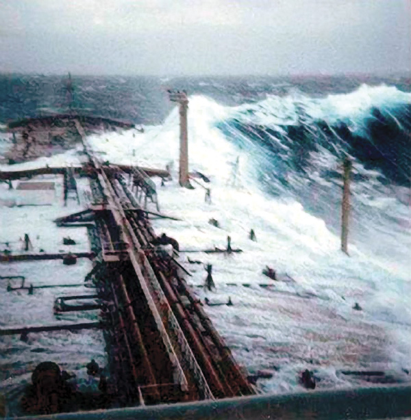
A large freak wave (15–20 m high) hits an ocean
vessel from behind during moderate sea state conditions of
about 4–5 m. © Philippe Lijour