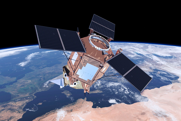
Artist's impression of the Sentinel-5P satellite. Image: ESA/ATG medialab
Satellites provide more than 95% of the tens of millions of weather observations ECMWF uses every day. While they are critical to success and deliver huge benefits, exploiting measurements from space can be challenging and some satellite observations are yet to be used to their full potential in weather forecasting. ECMWF scientists are at the forefront of efforts to maximise the exploitation and impact of these data for weather forecasting and other environmental applications.
Our long-standing partnerships with space agencies, especially EUMETSAT and ESA, are crucial for the successful exploitation of satellite observations at ECMWF. In return, we provide valuable feedback on the quality of the data and regular assessments of the impact of different types of data on global NWP. Such assessments help guide the planning of future missions. We also work with agencies in the United States (notably NASA, NOAA, and the Department of Defense), Japan (JMA and JAXA), Korea (KMA), China (CMA) and Brazil (INPE).
The role of satellites in weather forecasts
Satellite data saves lives and improves resilience by enabling better and longer-range weather forecasts, in particular those during extreme weather events. It is impossible to make weather observations everywhere using just surface, sea and airborne sensors. Satellites are the only way to gather the global three-dimensional atmospheric information needed to make skilful medium-range predictions. It is estimated that without them the range of useful weather forecast skill could be reduced by as much as 24 hours in the northern hemisphere and as much as 72 hours in the southern hemisphere.
Harnessing satellite observations
Satellites provide weather information by making highly accurate and detailed measurements of atmospheric radiation over a wide range of spectral bands (e.g. infrared, visible, ultraviolet, microwave and radar). These indirect observations from space require sophisticated data assimilation techniques to interpret the complex radiation signals in terms of the required meteorological variables, such as temperature and wind. Exploiting satellite data remains challenging and some satellite observations are not yet used to their full potential in weather forecasting. However, ECMWF scientists are at the forefront of efforts to harness more useful weather information from the wealth of available data.
The all-sky approach
One example is ECMWF’s groundbreaking all-sky approach to microwave data, which has enabled the extraction of humidity information in the presence of clouds and precipitation. All-sky is the first of its kind used in any operational weather model in the world. Its success has emboldened scientists to begin examining its potential for other measurements including infrared, radar and lidar.
For more information, see Assimilating observations sensitive to cloud and precipitation (ECMWF Tech Memo).
Improving the forecast model
Satellite observations also help scientists better understand complex weather processes – such as the interactions between clouds and radiation – so they can improve the forecast model.
One improvement reduced solar radiation errors over parts of the oceans in numerical weather prediction and climate models. ECMWF found that, in some situations, too little radiation is reflected in the models due to a lack of supercooled liquid water at convective cloud tops. The observations used came from a number of satellite instruments, including a lidar that provides high-resolution vertical profiles of clouds.
Observation monitoring
ECMWF's automated monitoring and alarm system checks hundreds of millions of satellite observations every day. It can detect even very small anomalies in the measurements, protecting our own forecasts from bad data and issuing warnings to data providers and other NWP centres. We also work with satellite partners around the world, using our monitoring system to assist in the post-launch calibration and validation of new satellite instruments.
For more information, see Monitoring of the observing system.
Support for new satellite missions
Satellite launches require a great deal of forward planning to ensure successful outcomes and value for money. ECMWF works with satellite agencies to help ensure that future space programmes deliver observations that will meet the requirements of operational meteorology and atmospheric science. One example is Aeolus, an ESA Earth Explorer mission.
Environmental observations
Satellites have a growing role in climate observation to help governments improve resilience in the face of climate change. The Copernicus Climate Change Service and Copernicus Atmosphere Monitoring Service, operated by ECMWF on behalf of the EU, are two examples of European programmes crucial to planning and resilience.
Research and training
We host EUMETSAT Fellows and visiting scientists from CMA and JMA, and work with EUMETSAT to provide training on satellite data assimilation. Our scientists work on satellite-related research projects funded by ESA, EUMETSAT and the EU. More information about such research is provided in the ESA Reports and EUMETSAT/ECMWF Fellowship Programme Research Reports.
