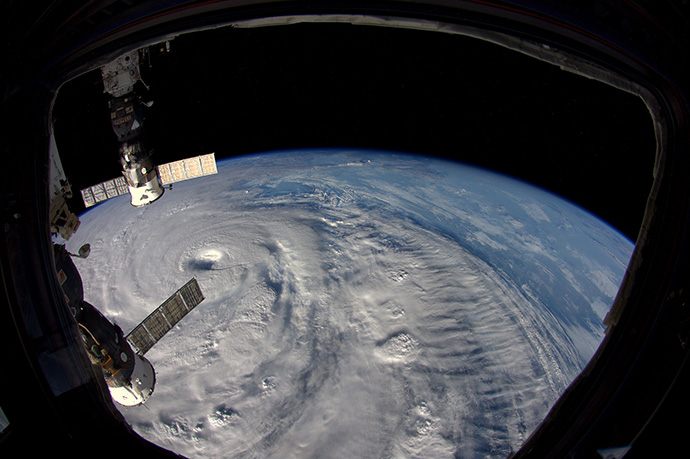

Typhoon Neoguri approaching Japan in July 2014, as seen from the International Space Station 400 km above. (Copyright: ESA/NASA)
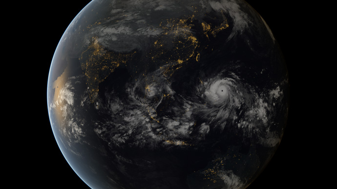
Tropical cyclones are one of the deadliest weather phenomena. Typhoon Haiyan, for example, caused more than 6,000 fatalities when it struck the Philippines in November 2013.
One of the avenues being pursued at ECMWF to improve forecasts of tropical cyclones is to better take into account interactions between the ocean and the atmosphere during the forecast period.
Experiments have shown that coupling the ocean and the atmosphere in the forecast model leads to better predictions of tropical cyclone intensity.
Coupling does not improve the forecast in all circumstances. It is particularly important when there is only a relatively shallow top layer of warm ocean water.
Heat transport
The main energy source for tropical cyclones is heat transport from the ocean into the atmosphere. If there is only a shallow top layer of warm water, the amount of energy that is released into the atmosphere may diminish relatively quickly. The water cools and the cyclone begins to weaken.
Not coupling the atmosphere and the ocean in the forecast model means that the ocean acts as an undiminished source of energy for the atmosphere during the forecast period. This may allow the cyclone intensity in the forecast to increase unrealistically.
Typhoon Neoguri, which hit Japan in July 2014, is an example where coupling makes a difference.

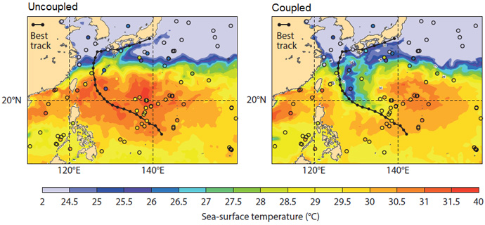
Five-day sea-surface temperature (SST) forecasts for the area of Neoguri starting on 5 July 2014 using the uncoupled model (left) and the coupled model (right). SST observations from ships and buoys (circles) confirm that the coupling leads to more realistic SST predictions along the path of the cyclone (‘best track’ data – black line).
The heat transfer between the ocean and the atmosphere leads to a dip in sea-surface temperature along the track of the cyclone. This is missing in the uncoupled forecast shown in the left-hand panel above, but it is well represented in the coupled forecast shown in the right-hand panel.
Better forecasts
The effect on the quality of intensity forecasts can be impressive.

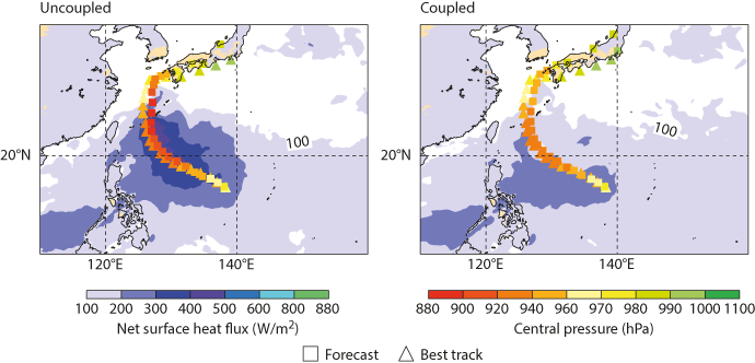
Five-day high-resolution track and intensity forecasts (squares) starting on 5 July 2014 together with ‘best track’ estimates (triangles) and the predicted net surface heat flux (shading) for Typhoon Neoguri using the uncoupled model (left) and the coupled model (right).
As shown above, an uncoupled forecast overpredicts the central pressure of Neoguri over much of its track. When the ocean and the atmosphere are coupled in the forecast, there is a much better match between the forecast and the subsequent best estimate of what really happened (‘best track’ data).
The reason is a more realistic modelling of the heat flux between the ocean and the atmosphere in the coupled forecast (blue shading in the charts).
The predicted track of Neoguri is fairly accurate in either case. It is not much affected by ocean coupling.
Limitations
Improvements in forecast quality are not seen in all cases. Typhoon Haiyan is an example where coupling has little effect on the forecast.
The reason is that Haiyan was marked by a thick warm top layer of ocean water which was not easily depleted.
ECMWF’s forecast at the time predicted the track of Haiyan well but underestimated its intensity. Ocean coupling does not reduce this error.
Other avenues, such as increased resolution in the atmospheric model, will have to be pursued to further reduce tropical cyclone intensity errors.

Typhoon Haiyan caused devastation when it struck the Philippines in November 2013. (Copyright: 2013 EUMETSAT)
Operational implementation
Ocean coupling is implemented by allowing different variables in the ocean, wave and atmospheric models to affect each other.
These include surface roughness from the wave model, sea-surface temperatures and surface currents from the ocean model, and winds and heat fluxes from the atmospheric model.
Coupling is already operational for ECMWF’s ensemble forecasts (ENS, horizontal resolution of 18 km) and is due to be extended to high-resolution forecasts (HRES, horizontal resolution of 9 km) in the next upgrade of ECMWF’s Integrated Forecasting System (IFS).
For more information, see ECMWF Technical Memorandum No. 794 on Tropical Cyclone Sensitivity to Ocean Coupling.
