
Every 13 October, the UN-sponsored International Day for Disaster Reduction celebrates how people and communities around the world are reducing their exposure to disasters.
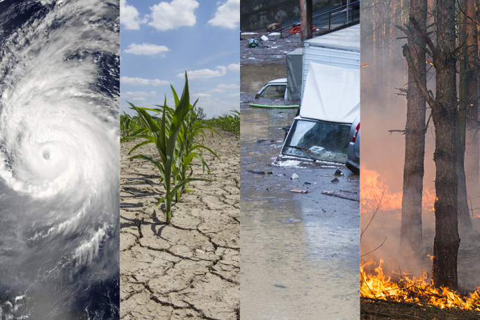
From storms, droughts and heatwaves to floods and wildfires, many disasters are weather-related.
Through close links with its Member and Co-operating States, UN agencies and other organisations, ECMWF’s global weather forecasts help governments and emergency services to prepare for weather-related disasters.
Storms, heatwaves and droughts
Storms can cause the loss of life as well as huge damage. Globally they are the most deadly type of weather-related disaster, according to a UN-sponsored study covering the period 1995 to 2015.
Heatwaves or cold spells can affect people’s health. In high-income countries, most weather-related deaths are due to extreme temperatures, especially heatwaves, the same study reports.
Droughts are extended periods of below-average precipitation compared to normal conditions. They can cause water shortages and affect crops.
ECMWF’s medium-range forecasts include predictions of wind, waves, precipitation and temperature up to 15 days in advance.
Beyond that, extended-range forecasts (up to 46 days ahead) and seasonal forecasts (up to 13 months ahead) can give indications that on average conditions are expected to be windier, drier, hotter or colder than usual.
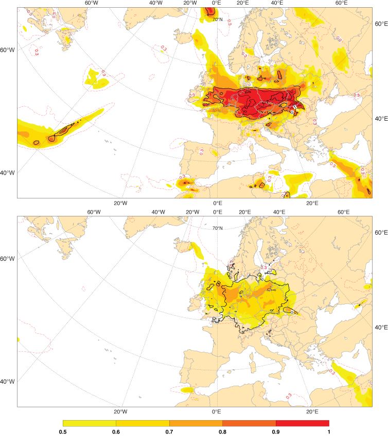
An important product is ECMWF’s Extreme Forecast Index (EFI). It highlights areas where weather variables are predicted to deviate substantially from the model climate for that region and time of year.

The charts show the Extreme Forecast Index (EFI) for 10-metre wind gusts on 5 October 2017 one day (top) and five days (bottom) ahead. Storm Xavier brought strong wind gusts over parts of the Netherlands, Germany and Poland that day, causing fatalities and disrupting transport.
EFI variables include 2-metre minimum, maximum and mean temperatures, total precipitation, snowfall, wind gust and mean wind speed, significant wave height, CAPE and CAPE-shear.
Agencies and organisations in the UN system, such as the World Health Organization (WHO) and the United Nations Office for Disaster Risk Reduction (UNISDR), can use graphical EFI products to aid decision-making and planning during emergencies.
Floods and wildfires
Floods and wildfires do not depend on weather conditions alone, but they are strongly influenced by them.
Large amounts of rainfall can cause floods, while dry conditions can increase fire danger.
Global weather predictions can thus help in the prediction of flood risk and fire danger conditions across the globe.
ECMWF data feed into the flood and fire danger predictions made available through the EU-funded Copernicus Emergency Management Service (CEMS).
ECMWF is the computational centre for the European Flood Awareness System (EFAS) and the Global Flood Awareness System (GloFAS), which are both part of CEMS. It also produces European and global fire danger forecasts for CEMS.
Availability of ECMWF forecasts
All ECMWF weather forecasts are available to the Centre’s Member and Co-operating States and to full licence holders.
A subset of ‘WMO Essential’ data, including tropical cyclone tracks, is freely available to the public without restriction, while a larger set of ‘WMO Additional’ products is freely available to WMO Members.
ECMWF provides additional graphical products to the WMO's Severe Weather Forecasting Demonstration Project (SWFDP), which is strengthening the capacity of developing and least developed countries to deliver improved forecasts and warnings of severe weather.
In exceptional circumstances, ECMWF’s Director-General can authorise the release of ECMWF products to support emergency management, as happened in Peru in 2017.
Reduced-fee licences, some supported by the WMO and the World Bank, are available for national meteorological and hydrological services, giving access either to web charts or to the whole range of real-time products.
For more information, please visit our web page on accessing ECMWF’s forecasts.
Top image credits (left to right): Stocktrek Images/Thinkstock; Taglass/iStock/Thinkstock; fotonazario/iStock/Thinkstock; Gilitukha/iStock/Thinkstock
