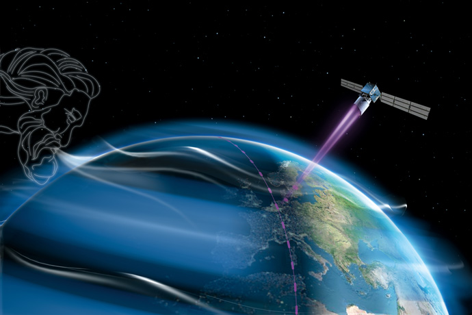

Aeolus can measure winds up to an altitude of about 30 km. (Image: ESA/AOES Medialab)
The Aeolus satellite was launched successfully by the European Space Agency (ESA) from the European spaceport in Kourou, French Guiana, on 22 August 2018.
The mission is expected to improve weather forecasts by providing vital information on winds across the globe.
ECMWF will process the Aeolus data to provide wind products suitable for use in numerical weather prediction.
A ground-breaking mission
Aeolus is the first space mission to acquire profiles of the wind on a global scale. Currently wind-field information in remote regions, over the oceans, in the tropics and in the southern hemisphere is largely indirect.
Simulated data show that Aeolus wind information will be much more comprehensive and more accurate than wind information from other satellite sources.
Aeolus is a pre-operational mission, demonstrating new laser technology and paving the way for future meteorological satellites to measure atmospheric winds.
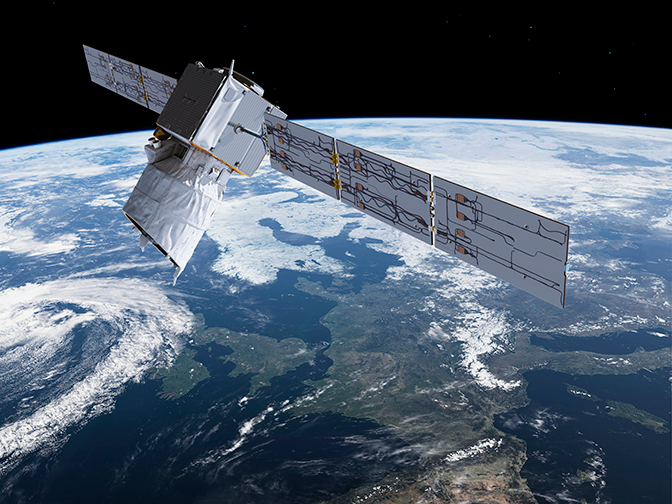
It uses a laser Doppler wind lidar called Aladin, the first ever instrument of this type to be launched into space.
The instrument aims an ultraviolet beam into the atmosphere. The Doppler-shift of the light backscattered from both clear air molecules and clouds or aerosols can be used to infer the wind speed at different altitudes.

The Aeolus satellite carries just one large instrument, a laser Doppler wind lidar called Aladin. It works by aiming an ultraviolet (UV) laser into the atmosphere and then detecting the Doppler-shift of the backscattered light. (Image: ESA/ATG Medialab)
Better forecasts
Aeolus could herald a step change in the quality of weather forecasts around the globe.
The new near-real-time wind information it provides is expected to lead to much-improved analyses of the state of the atmosphere in the tropics.
This is expected to have a major impact on forecast quality in the tropics and a smaller but still important impact in the extratropics, especially in the medium range.
Aeolus will also help to improve forecasts more indirectly by acting as a quality-control standard for other sources of remote-sensing data.
Finally, Aeolus data will help to advance our understanding of tropical dynamics. The insights gained can help to improve the weather models used to produce forecasts.

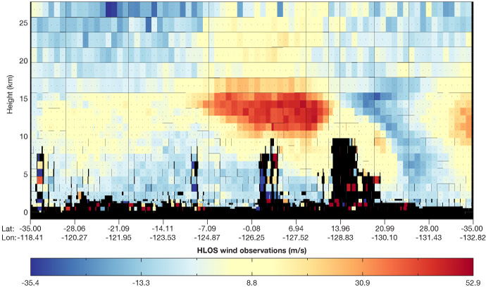
This example of simulated Aeolus horizontal-line-of-sight (HLOS) wind observations shows that Aeolus will see near-full vertical profiles of winds, limited only by the presence of thick clouds (black areas), which the laser light cannot penetrate.
ECMWF’s role
ECMWF has been chosen as the Level-2 Meteorological Processing Facility. This means it will provide wind products and supporting meteorological data products for ESA in an operational manner during the mission’s lifetime.
The Centre will also be responsible for monitoring Aeolus wind retrievals, and it will assess the impact of Aeolus winds on global numerical weather prediction.
The intention is to assimilate Aeolus observations operationally if they can provide the expected positive impact on forecasts.
ECMWF will also participate in readiness tests, calibration/validation activities and the mission’s commissioning phase.
For more information, see the Science Blog post on Aeolus by Lars Isaksen and Michael Rennie.
