ECMWF periodically uses its forecast models and data assimilation systems to 'reanalyse' archived observations, creating global data sets describing the recent history of the atmosphere, land surface, and oceans. The essence of this process, which provides consistent and convenient 'maps without gaps', is explained in this animation.
Reanalysis is very popular and is used for monitoring climate change, for research and education, and for commercial applications.
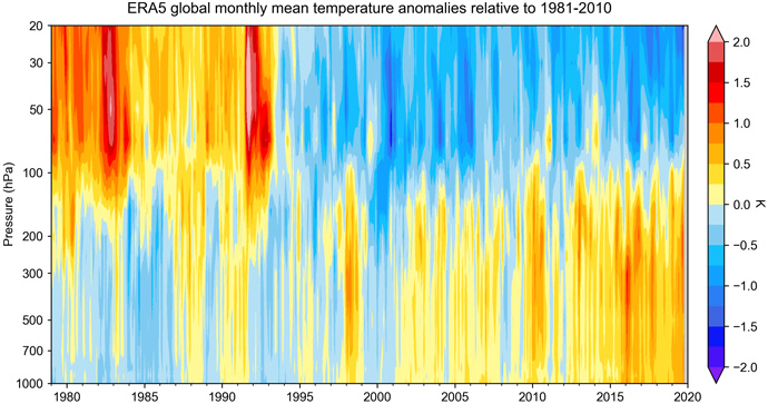
The latest ECMWF reanalysis is ERA5, which is being produced by C3S. ERA5 provides a snapshot of the atmosphere, land surface and ocean waves for each hour from 1959 onwards (for 1950 to 1958 a preliminary version is available). It includes an uncertainty estimate which highlights the considerable evolution of the observing system, on which reanalysis products rely.

Reanalysis requires special developments to ensure the best possible temporal consistency of its products, which can be adversely affected by biases in models and observations, and by the ever-changing observing system. Current research at ECMWF focuses on the development of consistent reanalyses of the coupled climate system, including atmosphere, land surface, ocean, sea ice, and the carbon cycle, extending back as far as a century or more. An additional research topic is directed towards an improved handling of systematic model bias.
The work also involves the inclusion, preparation and assessment of newly available climate observations, ranging from early in-situ surface observations made by meteorological observers to modern high-resolution satellite data sets. In addition, new generations of reanalysis benefit from improved versions of existing observations, such as the latest available reprocessed satellite records from space agencies.
What is climate reanalysis?
A climate reanalysis gives a numerical description of the recent climate, produced by combining models with observations. It contains estimates of atmospheric parameters such as air temperature, pressure and wind at different altitudes, and surface parameters such as rainfall, soil moisture content, ocean-wave height and sea-surface temperature. The estimates are produced for all locations on earth, and they span a long time period that can extend back several decades or more. Climate reanalyses generate large datasets that can take up several petabytes of space, and are best processed with cloud-based tools, to avoid large download volumes.
